Vivian Tran (she/they)
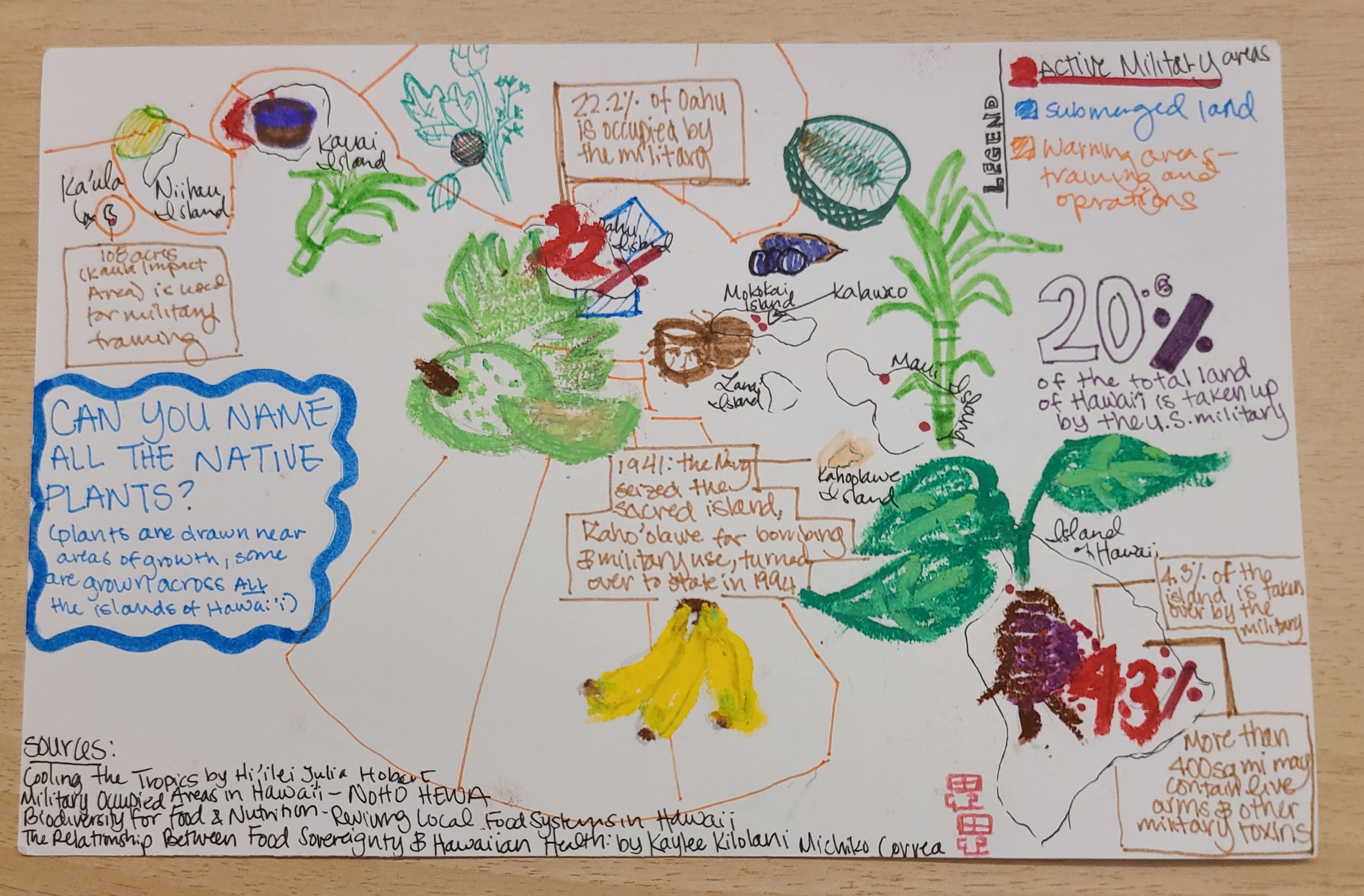
Mixed-media art of a map of Hawai’i with colored active military zones, submerged land, and warning areas of military training and operations. Each island has pop up descriptions and statistics written in large fonts describing the military presence that is and has been on different islands of Hawai’i. Native plants for food are drawn in mixed media format throughout and around the islands: taro, breadfruit, sugarcane, coconut, bananas, and kukui nuts. Along the right edge is the question: “Can you name all the native plants?”. Sources are listed along the bottom right corner that were used to make this artwork.
After reading Cooling the Tropics by Hi’ilei Hobart, I wanted to make an image looking at food sovereignty in Hawai’i. Because of American imperialism and colonialism, majority of the food in Hawai’i is imported, the usage of ice and thermal colonialism that Dr. Hobart discusses in her book dives into this. I chose to contrast the military occupation of Hawai’i as it continues to impact food sovereignty for Kanaka (Native Hawaiians) and settlers. I looked at plants that are native to Hawai’i and where they are grown now. I tried to keep plants near where they primarily grow, some grow in all the islands while others are only in a few. I included the question of “Can you name all the native plants?” to encourage engagement with the work, to ask the viewer what plants do you recognize that are significant to Kanaka historically and support food sovereignty for all people in Hawai’i.

